![](/images/other/stat-length.png)
![Randonnée A pied Kiens - Chienes - Sentiero TV n. 65 - Photo](https://media.geolcdn.com/t/1900/400/c40750f5-e2b0-40ef-9f37-999de9619736.jpeg&format=pjpeg&maxdim=2)
Sentiero TV n. 65
SityTrail - itinéraires balisés pédestres
Tous les sentiers balisés d’Europe GUIDE+
![Longueur](/images/other/stat-length.png)
Longueur
12 km
![Altitude max](https://static1.geolcdn.com/siteimages/upload/files/1508320355ic_sort_altitude_max_24dp.png)
Altitude max
2410 m
![Dénivelé positif](https://static1.geolcdn.com/siteimages/upload/files/1508320355ic_sort_den_pos_24dp.png)
Dénivelé positif
1599 m
![Km-Effort](/images/other/stat-length.png)
Km-Effort
28 km
![Altitude min](https://static1.geolcdn.com/siteimages/upload/files/1508320355ic_sort_altitude_min_24dp.png)
Altitude min
809 m
![Dénivelé négatif](https://static1.geolcdn.com/siteimages/upload/files/1508320355ic_sort_den_neg_24dp.png)
Dénivelé négatif
2 m
![Boucle](https://static1.geolcdn.com/siteimages/upload/files/16400158638029165_repeat_loop_refresh_sync_direction_icon.png)
Boucle
Non
Balise
Date de création :
2022-02-17 10:56:40.199
Dernière modification :
2022-03-02 01:40:08.761
![A pied](https://static1.geolcdn.com/sitytour/trail-icons/100.png)
6h22
Difficulté : Moyen
![Scannez ce code QR pour ouvrir la randonnée dans l'application SityTrail](https://capi.geolives.com/qq0zvz2zws4bq2lad0pu/sitytour/trails/3130723/qr.png?size=200)
Application GPS de randonnée GRATUITE
À propos
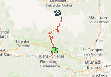
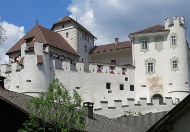
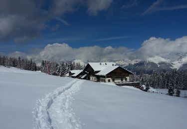
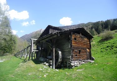
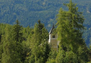
Randonnée A pied de 12 km à découvrir à Trentin-Haut-Adige, Haut-Adige, Kiens - Chienes. Cette randonnée est proposée par SityTrail - itinéraires balisés pédestres.
Description
Randonnée créée par TV.
Symbole: rosso-bianco-rosso con il numero 65 in nero sulla striscia bianca
Localisation
Pays :
Italie
Région :
Trentin-Haut-Adige
Département/Province :
Haut-Adige
Commune :
Kiens - Chienes
Localité :
Kiens
Départ:(Dec)
Départ:(UTM)
716522 ; 5187744 (32T) N.
Commentaires
Randonnées à proximité
![Randonnée A pied Kiens - Chienes - Kienbergweg - Photo](https://media.geolcdn.com/t/375/260/6ad59771-6284-4240-8beb-178277fa0d2b.jpeg&format=jpg&maxdim=2)
![A pied A pied](https://static1.geolcdn.com/sitytour/trail-icons/100.png)
Kienbergweg
A pied
Facile
Kiens - Chienes,
Trentin-Haut-Adige,
Haut-Adige,
Italie
![](/images/other/stat-length.png)
7 km | 13,9 km-effort
3h 9min
![](https://static1.geolcdn.com/siteimages/upload/files/16400158638029165_repeat_loop_refresh_sync_direction_icon.png)
Non
![Randonnée A pied St. Lorenzen - San Lorenzo di Sebato - Wanderweg 10 - Photo](https://media.geolcdn.com/t/375/260/db563c96-c89f-42fe-89e3-af6be66e3232.jpeg&format=jpg&maxdim=2)
![A pied A pied](https://static1.geolcdn.com/sitytour/trail-icons/100.png)
Wanderweg 10
A pied
Facile
St. Lorenzen - San Lorenzo di Sebato,
Trentin-Haut-Adige,
Haut-Adige,
Italie
![](/images/other/stat-length.png)
6 km | 8,5 km-effort
1h 55min
![](https://static1.geolcdn.com/siteimages/upload/files/16400158638029165_repeat_loop_refresh_sync_direction_icon.png)
Non
![Randonnée A pied Kiens - Chienes - Wanderroute 11 - Photo](https://media.geolcdn.com/t/375/260/2910833d-70a4-4f6f-a392-2eacbfd31e62.jpeg&format=jpg&maxdim=2)
![A pied A pied](https://static1.geolcdn.com/sitytour/trail-icons/100.png)
Wanderroute 11
A pied
Facile
Kiens - Chienes,
Trentin-Haut-Adige,
Haut-Adige,
Italie
![](/images/other/stat-length.png)
7 km | 13,5 km-effort
3h 4min
![](https://static1.geolcdn.com/siteimages/upload/files/16400158638029165_repeat_loop_refresh_sync_direction_icon.png)
Non
![Randonnée A pied Rodeneck - Rodengo - Wanderroute 68 - Photo](https://media.geolcdn.com/t/375/260/34e9c99b-2ba6-41db-a7bc-8b504f1938d4.jpeg&format=jpg&maxdim=2)
![A pied A pied](https://static1.geolcdn.com/sitytour/trail-icons/100.png)
Wanderroute 68
A pied
Facile
Rodeneck - Rodengo,
Trentin-Haut-Adige,
Haut-Adige,
Italie
![](/images/other/stat-length.png)
9,3 km | 13,7 km-effort
3h 6min
![](https://static1.geolcdn.com/siteimages/upload/files/16400158638029165_repeat_loop_refresh_sync_direction_icon.png)
Non
![Randonnée A pied Terenten - Terento - IT-8A - Photo](https://media.geolcdn.com/t/375/260/1aea0979-9932-46e2-ad23-b647c22659c1.jpeg&format=jpg&maxdim=2)
![A pied A pied](https://static1.geolcdn.com/sitytour/trail-icons/100.png)
IT-8A
A pied
Facile
Terenten - Terento,
Trentin-Haut-Adige,
Haut-Adige,
Italie
![](/images/other/stat-length.png)
3,7 km | 4,8 km-effort
1h 6min
![](https://static1.geolcdn.com/siteimages/upload/files/16400158638029165_repeat_loop_refresh_sync_direction_icon.png)
Non
![Randonnée A pied St. Lorenzen - San Lorenzo di Sebato - Rundweg Klosterwald - Photo](https://media.geolcdn.com/t/375/260/a781e342-1aae-4abd-91dd-d118914c1fba.jpeg&format=jpg&maxdim=2)
![A pied A pied](https://static1.geolcdn.com/sitytour/trail-icons/100.png)
Rundweg Klosterwald
A pied
Facile
St. Lorenzen - San Lorenzo di Sebato,
Trentin-Haut-Adige,
Haut-Adige,
Italie
![](/images/other/stat-length.png)
6,3 km | 8,7 km-effort
1h 58min
![](https://static1.geolcdn.com/siteimages/upload/files/16400158638029165_repeat_loop_refresh_sync_direction_icon.png)
Oui
![Randonnée A pied Kiens - Chienes - Wanderroute 15 - Photo](https://media.geolcdn.com/t/375/260/82ef480e-999c-44dd-a188-2df32b2e9f38.jpeg&format=jpg&maxdim=2)
![A pied A pied](https://static1.geolcdn.com/sitytour/trail-icons/100.png)
Wanderroute 15
A pied
Facile
Kiens - Chienes,
Trentin-Haut-Adige,
Haut-Adige,
Italie
![](/images/other/stat-length.png)
3 km | 4,3 km-effort
58min
![](https://static1.geolcdn.com/siteimages/upload/files/16400158638029165_repeat_loop_refresh_sync_direction_icon.png)
Non
![Randonnée A pied Kiens - Chienes - Höfeweg - Photo](https://media.geolcdn.com/t/375/260/0abdafd8-d8e6-4b7b-907e-de4e33c1e10a.jpeg&format=jpg&maxdim=2)
![A pied A pied](https://static1.geolcdn.com/sitytour/trail-icons/100.png)
Höfeweg
A pied
Facile
Kiens - Chienes,
Trentin-Haut-Adige,
Haut-Adige,
Italie
![](/images/other/stat-length.png)
10,9 km | 17,8 km-effort
4h 2min
![](https://static1.geolcdn.com/siteimages/upload/files/16400158638029165_repeat_loop_refresh_sync_direction_icon.png)
Non
![Randonnée A pied Terenten - Terento - IT-4 - Photo](https://media.geolcdn.com/t/375/260/f0ef4367-164d-4bd8-bef6-32376d5c67a4.jpeg&format=jpg&maxdim=2)
![A pied A pied](https://static1.geolcdn.com/sitytour/trail-icons/100.png)
IT-4
A pied
Facile
Terenten - Terento,
Trentin-Haut-Adige,
Haut-Adige,
Italie
![](/images/other/stat-length.png)
4,3 km | 6,5 km-effort
1h 28min
![](https://static1.geolcdn.com/siteimages/upload/files/16400158638029165_repeat_loop_refresh_sync_direction_icon.png)
Non